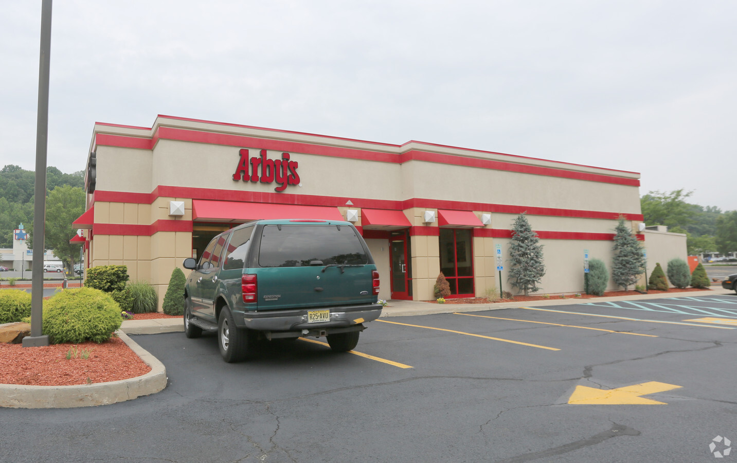
Property Record
1701 Route 22, Watchung, NJ 07069
NEARBY LISTINGS FOR SALE OR LEASE
Property Detail
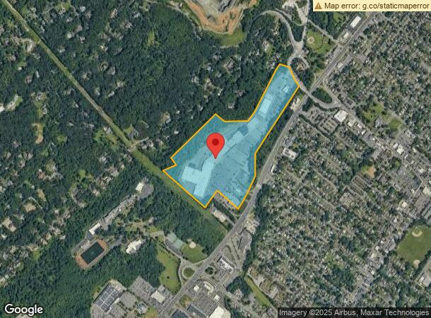
1701 Route 22
Northern New Jersey
ADDITIONAL LOTS: OID 64.11
Newark, NJ-PA
Somerset
21-06404-0000-00002-01
New Jersey
Regionalshoppingcenterormallwithanchorstore
2.1
2024
47.80 AC
2024
Route 78 East
052300
DEMOGRAPHICS near 1701 Route 22
1 Mile
3 Mile
5 Mile
2024 Total Population
11,409
111,919
265,773
2029 Population
11,262
110,814
263,622
Pop Growth 2024-2029
(1.29%)
(0.99%)
(0.81%)
Average Age
40
39
40
2024 Total Households
3,946
36,915
89,550
HH Growth 2024-2029
(1.34%)
(1.06%)
(0.88%)
Median Household Inc
$113,238
$115,367
$123,990
Avg Household Size
2.80
2.90
2.90
2024 Avg HH Vehicles
2.00
2.00
2.00
Median Home Value
$482,028
$593,338
$599,749
Median Year Built
1954
1956
1958
Nearby Places
- Restaurants
- Banks
- Shops
- Fitness
- Groceries
PUBLIC TRANSPORTATION
COMMUTER RAIL
Fanwood (Raritan Valley Line - NJ Transit Commuter Rail (NJ Transit))
DRIVE
WALK
Distance
Fanwood (Raritan Valley Line - NJ Transit Commuter Rail (NJ Transit))
6 min
2.1 mi
Netherwood (Raritan Valley Line - NJ Transit Commuter Rail (NJ Transit))
DRIVE
WALK
Distance
Netherwood (Raritan Valley Line - NJ Transit Commuter Rail (NJ Transit))
7 min
2.5 mi
AIRPORT
Newark Liberty International
DRIVE
WALK
Distance
Newark Liberty International
24 min
17.7 mi
Laguardia
DRIVE
WALK
Distance
Laguardia
59 min
37.0 mi
Freight Ports
New York Container Terminal
DRIVE
WALK
Distance
New York Container Terminal
31 min
17.2 mi
Nearby Properties
Address
Land Use
TOTAL SIZE
Lot Size
Zoning
Address
Land Use
TOTAL SIZE
Lot Size
Zoning
151,088 SF
26.48 AC
CCRC
Address
Land Use
TOTAL SIZE
Lot Size
Zoning
20.08 AC
RML1
Address
Land Use
TOTAL SIZE
Lot Size
Zoning
153.40 AC
OR
Address
Land Use
TOTAL SIZE
Lot Size
Zoning
31,905 SF
14.32 AC
Address
Land Use
TOTAL SIZE
Lot Size
Zoning
439.33 AC
Address
Land Use
TOTAL SIZE
Lot Size
Zoning
26.87 AC
H-D
Address
Land Use
TOTAL SIZE
Lot Size
Zoning
47.69 AC
MU
Address
Land Use
TOTAL SIZE
Lot Size
Zoning
34.60 AC
MU
Address
Land Use
TOTAL SIZE
Lot Size
Zoning
140,732 SF
42.73 AC
OR
Address
Land Use
TOTAL SIZE
Lot Size
Zoning
15.79 AC
H-D
Address
Land Use
TOTAL SIZE
Lot Size
Zoning
24.92 AC
MU
Address
Land Use
TOTAL SIZE
Lot Size
Zoning
12.47 AC
H-D
Address
Land Use
TOTAL SIZE
Lot Size
Zoning
Address
Land Use
TOTAL SIZE
Lot Size
Zoning
5.61 AC
Address
Land Use
TOTAL SIZE
Lot Size
Zoning
19.84 AC
Address
Land Use
TOTAL SIZE
Lot Size
Zoning
4.74 AC
NC
Address
Land Use
TOTAL SIZE
Lot Size
Zoning
19.84 AC
H-D
Address
Land Use
TOTAL SIZE
Lot Size
Zoning
61,912 SF
16 AC
OR
Address
Land Use
TOTAL SIZE
Lot Size
Zoning
19 AC
R-3
Address
Land Use
TOTAL SIZE
Lot Size
Zoning
356.94 AC
OL
Address
Land Use
TOTAL SIZE
Lot Size
Zoning
36.55 AC
OL
Address
Land Use
TOTAL SIZE
Lot Size
Zoning
184,000 SF
24.43 AC
OR
Address
Land Use
TOTAL SIZE
Lot Size
Zoning
120 SF
9.80 AC
Address
Land Use
TOTAL SIZE
Lot Size
Zoning
600,000 SF
2.72 AC
Address
Land Use
TOTAL SIZE
Lot Size
Zoning
122,820 SF
14.65 AC
H-D
Address
Land Use
TOTAL SIZE
Lot Size
Zoning
11.20 AC
Address
Land Use
TOTAL SIZE
Lot Size
Zoning
6.67 AC
R5
Address
Land Use
TOTAL SIZE
Lot Size
Zoning
28.80 AC
Address
Land Use
TOTAL SIZE
Lot Size
Zoning
9.06 AC
The World's #1 Commercial Real Estate Marketplace
Connect with us
© 2025 CoStar Group
The information above has been obtained from sources believed reliable. While we do not doubt its accuracy we have not verified it and make no guarantee, warranty or representation about it. It is your responsibility to independently confirm its accuracy and completeness. Any projections, opinions, assumptions, or estimates used are for example only and do not represent the current or future performance of the property. The value of this transaction to you depends on tax and other factors which should be evaluated by your tax, financial, and legal advisors. You and your advisors should conduct a careful, independent investigation of the property to determine to your satisfaction the suitability of the property for your needs.